Data Packs
The E3X’s navigation and chart data comes as a data pack for a region, today the continental United States (the 48 contiguous states and DC). The pack comes in parts, so you only download what you fly:
- Navigation databases, national, on the FAA’s 28-day cycle. They cover airports, runways, navaids, fixes and airways (FAA NASR), procedures (FAA CIFP), airspace, comm frequencies, and obstacles (FAA Digital Obstacle File). The FAA publishes the obstacle file every 56 days. Each cycle expires when its period ends. The Databases window tells you when a newer one is out.
- Base map data, downloaded once. It holds OpenStreetMap detail, Natural Earth urban areas, boundaries and a worldwide basemap, and time zones. It also holds a worldwide airport directory, historical weather-station data, and a small low-resolution worldwide terrain grid.
- Charts, per state: current-cycle approach plates and airport diagrams (FAA d-TPP) and Chart Supplement pages for the state’s airports. You also get every georeferenced VFR sectional and IFR enroute (low and high) chart sheet that touches the state. Georeferenced means the chart carries map coordinates, so the E3X can show your position on it. A sheet shared by two of your states downloads once.
Every state together comes to several gigabytes, most of it charts and plates. The navigation and base data are a small part of that.
Detailed terrain is not in the pack. With X-Plane, terrain and synthetic vision come from the simulator’s own scenery, so you download nothing for them. The small worldwide grid in the base map data fills in the map’s relief beyond the scenery you have installed.
Downloading data: Menu → Setup → Databases
Section titled “Downloading data: Menu → Setup → Databases”Day-to-day downloading, updating and removing happens inside the E3X: open
Menu → Setup → Databases. e3x-core datapack (install, status,
download, remove) is the command-line equivalent. The window has two tabs,
Navigation and Charts, and a CHECK button at the top right that looks
for newer data.
Navigation tab
Section titled “Navigation tab”The Navigation tab lists the five navigation databases: Navigation (FAA NASR), Procedures (FAA CIFP), Airspace, Comm Frequencies and Obstacles (FAA DOF). It also lists the Base Map Data - United States and Base Map Data - Europe rows. Each row shows its state:
- Not installed
- Cycle … – expires …
- Expired … – cycle …
- Update available – installed cycle …
- Expired … – update available
- Installed – edition … (base map data, which does not expire)
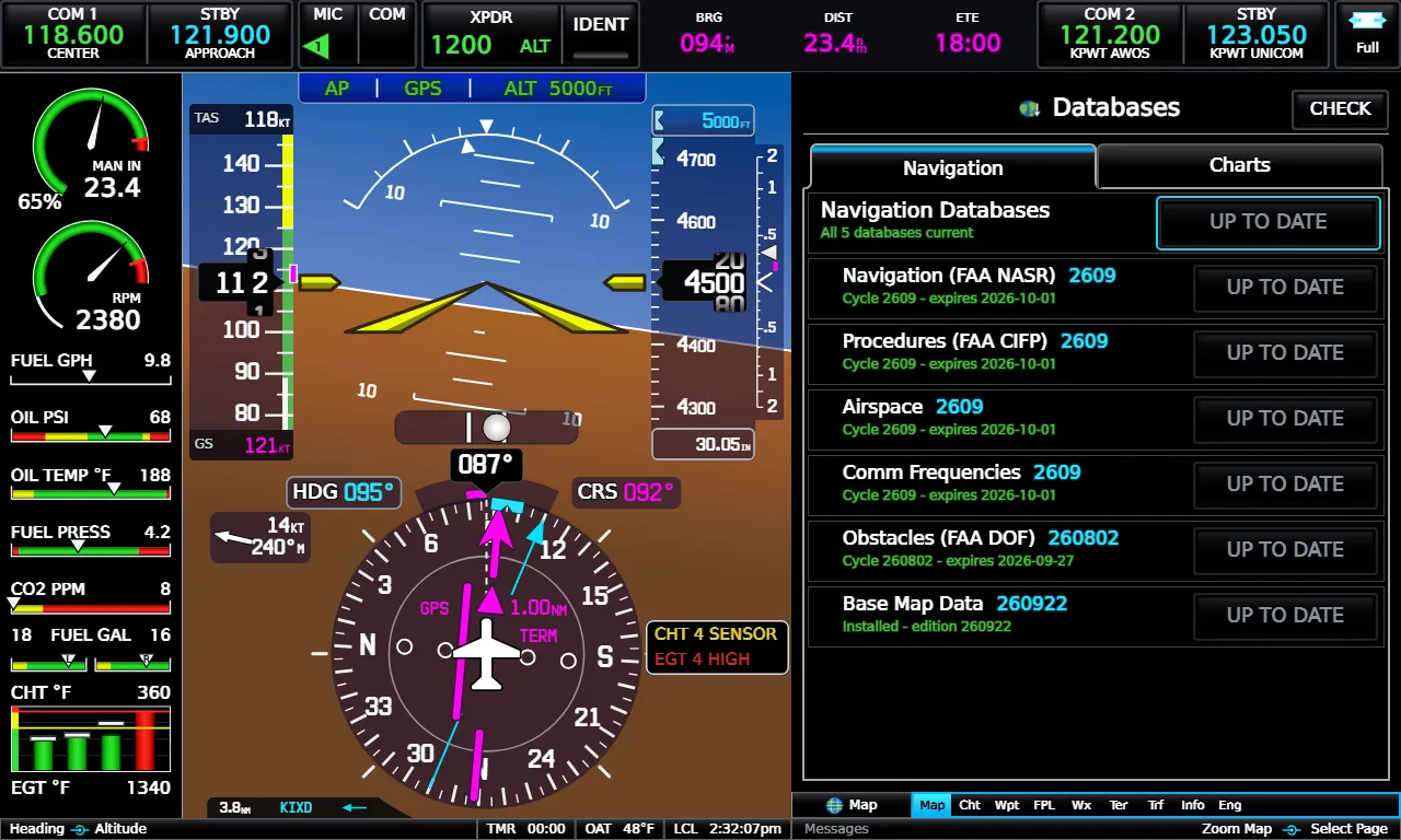
Each row’s button reads DOWNLOAD or UPDATE with its size, UP TO DATE, or NO UPDATE (expired, but nothing newer is out yet). The group’s own button at the top reads UPDATE ALL, or UP TO DATE when nothing needs fetching. It handles everything missing or out of date in one go. The Navigation tab never touches charts.
Charts tab
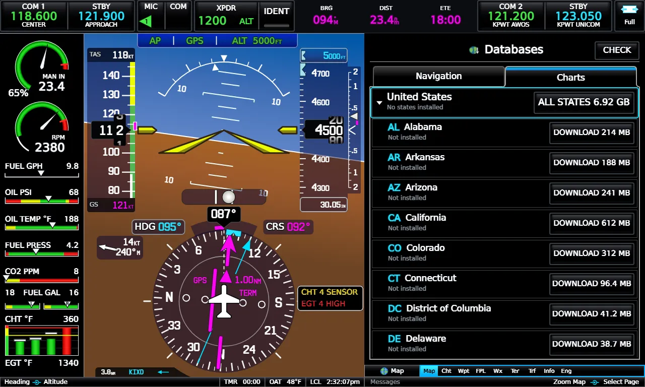
Section titled “Charts tab”The Charts tab has a United States group. Expand it for one row per state with its status (Not installed, Installed – cycle …, Update available – installed cycle …) and a DOWNLOAD, UPDATE or REMOVE button. The ALL STATES button at the top of the group fetches every state at once. A state download moves charts and plates only. REMOVE keeps any chart sheet that another installed state still needs.
A Europe group also appears. Its data is not published yet, so the group and the Base Map Data - Europe row read UNAVAILABLE.
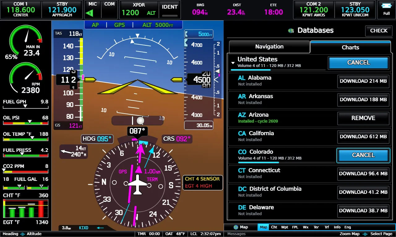
While a download runs, the row shows a progress bar with the volume count and bytes, and its button turns to CANCEL. Canceling keeps what has already arrived, so pressing DOWNLOAD again later resumes where it stopped. A download you start while another is running waits its turn, and its button reads QUEUED.
If the rows read NO PACK HOST, this copy of the E3X has no download server configured. If they read UNAVAILABLE, the E3X could not reach the server, so try again later. Data you already installed keeps working either way.
Data cycles
Section titled “Data cycles”The FAA publishes its data on 28-day cycles (56 days for obstacles and some
chart products).
Each product carries its own effective and expiration dates. A pack’s label
is its FAA NASR cycle: 2609 is the 9th cycle of 2026.
Expired data still displays, and the E3X does not refuse to run. However, plates, frequencies and procedures may no longer match the real world. The Databases window shows what has expired.
Where the data is stored
Section titled “Where the data is stored”| OS | Data folder |
|---|---|
| Windows | %LOCALAPPDATA%\EmreliaE3X\data |
| Linux | ~/.local/share/emrelia-e3x/data (or $XDG_DATA_HOME/emrelia-e3x/data) |
Partial downloads wait in run/downloads inside it until they finish. The
data folder also holds your settings, activation record and flight plans, so
updating a pack or reinstalling the E3X leaves them alone.
Emrelia E3X is an independent product of Emrelia LLC. It is not affiliated with, endorsed by, or sponsored by Garmin Ltd. or its affiliates. G3X Touch™ is a trademark of Garmin Ltd. For flight simulation use only — not for use in real-world navigation. Map imagery contains data © OpenStreetMap contributors (ODbL) and other sources — see data attributions. © 2026 Emrelia LLC.