Flight Planning
The active plan
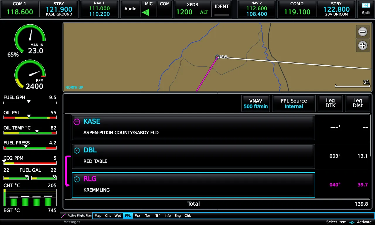
Section titled “The active plan”Open FPL from the main menu. Add Waypoint searches the database six ways — recent, nearest airports, flight-plan waypoints, user waypoints, by name, or by city — and the plan holds up to 300 waypoints. Touch any row for its action strip: Insert Before, Insert After, Remove, and Activate Leg. Destructive actions confirm first.
The two data columns are configurable — touch a column header to pick from thirteen fields, from leg distance and desired track to fuel remaining at waypoint, ETA, and METAR at waypoint. Cumulative fields draw cyan with a total row, per-leg fields white. Show Map collapses the inset map to show more rows; touching a waypoint row zooms the inset onto it.
Saved plans
Section titled “Saved plans”Main Menu → Flight Plan List stores up to 50 named plans, each listed with total distance and en-route safe altitude. The editor is the same page you use for the active plan — rename, invert, edit graphically, load an approach, then Activate when it’s time to fly it.
Direct-To
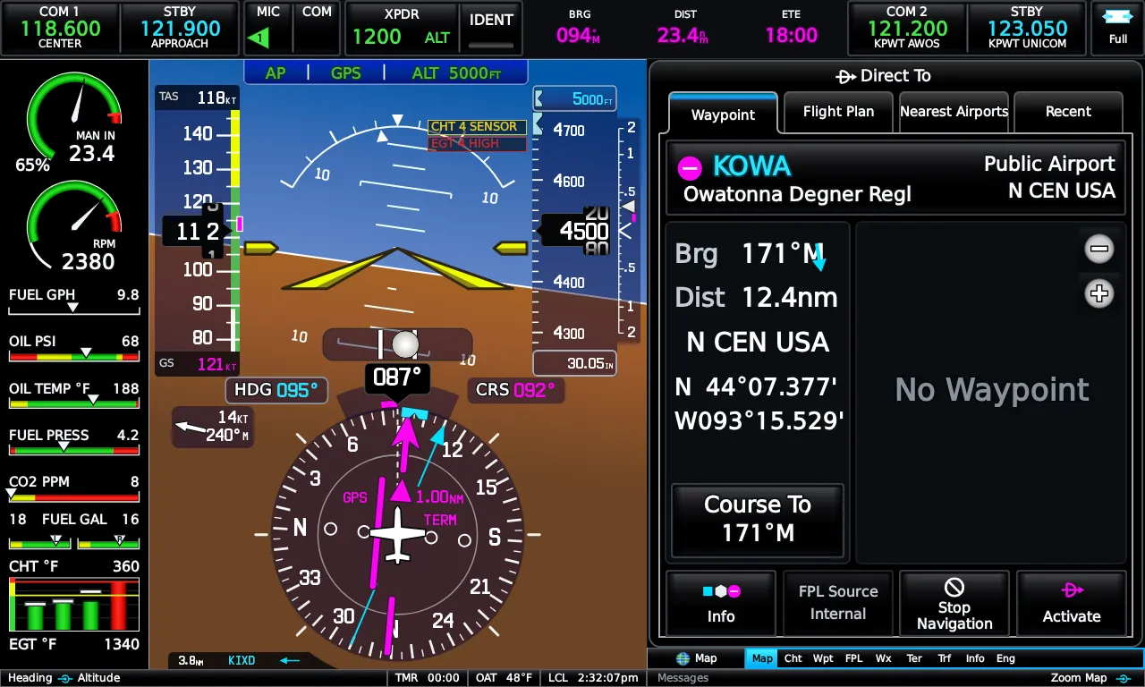
Section titled “Direct-To”Press the Direct-To key. The window’s four tabs — Waypoint, Flight Plan, Nearest, Recent — cover the usual cases in one or two taps, with a vicinity map and live bearing/distance to the candidate. Course To Waypoint takes a hand-dialed course instead of the direct bearing; a dialed course also makes the PFD’s CRS field editable, so you can trim it from the PFD afterwards. You can also fly Direct-To a raw map coordinate.
Graphical editing
Section titled “Graphical editing”Graphically Edit FPL (from the Map or FPL options) turns the map into an editor: touch a location for candidate waypoints, drag a leg to rubber-band a new waypoint into it, or create a user waypoint on the spot. Nothing touches the real plan until you save.
Approaches
Section titled “Approaches”Select Approach is available from the active plan, the saved-plan editor, the Direct-To window, and the airport’s waypoint page — same window everywhere, preloaded with the right airport.
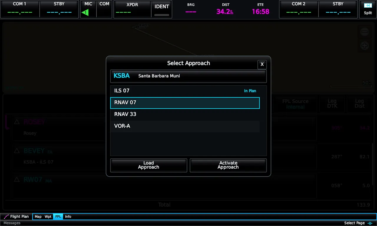
Load puts the approach in the plan while you keep navigating to it; Activate starts flying it. Vectors-to-final extends the final approach course for you to intercept. From the E3X’s internal database an approach contributes its final segment — the FAF and MAP as plan rows with approach guidance between them. When an external GTN- or GNS-class navigator owns the plan, the E3X mirrors the navigator’s complete procedures — transitions, stepdowns, and the missed approach — see Panel Integration.
The E3X flies the real unit’s single-profile VNAV: pick a reference waypoint from the route ahead, a target Altitude (MSL or above the waypoint), an offset (By a distance, before or after), and a descent rate. The page seeds sensible defaults — 500 fpm to 1000 ft above the waypoint, 3 nm before it — the moment you open it.
The solution drives the PFD’s VNAV chevron and required-vertical-speed cue, the top-of-descent countdown, and the AFCS VNAV mode. Capture VNAV Profile locks the descent path through your present position; Cancel VNAV Profile tears it down.
User waypoints
Section titled “User waypoints”Create a user waypoint from any map selection (or inside the graphical editor): name it, pick a map symbol, add a comment, adjust the position. Main Menu → User Waypoints manages them, including proximity waypoints that draw an alert radius on the map.
Emrelia E3X is an independent product of Emrelia LLC. It is not affiliated with, endorsed by, or sponsored by Garmin Ltd. or its affiliates. G3X Touch™ is a trademark of Garmin Ltd. For flight simulation use only — not for use in real-world navigation. Map imagery contains data © OpenStreetMap contributors (ODbL) and other sources — see data attributions. © 2026 Emrelia LLC.