Moving Map & Charts
The map page and the chart products behind it.
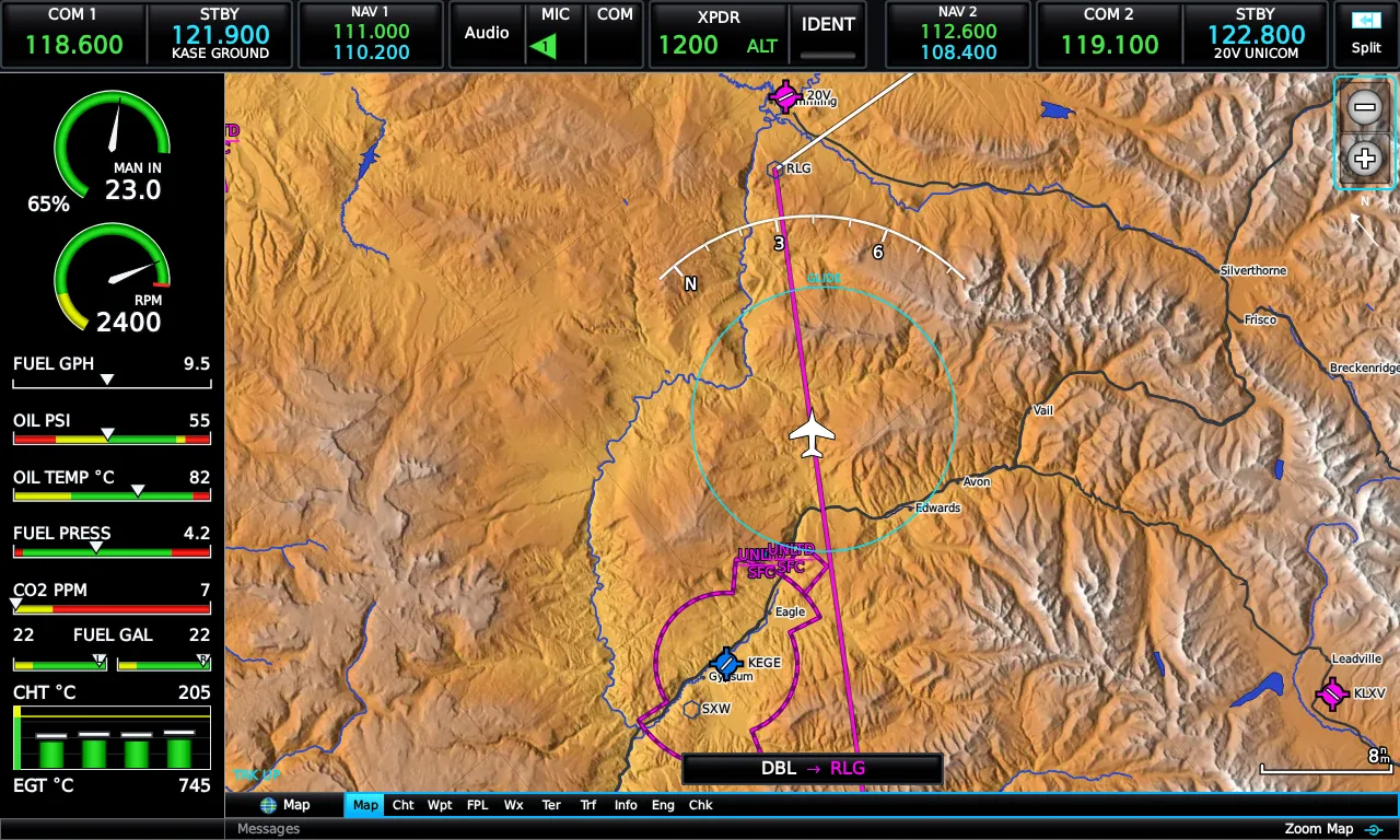
The Map page
Section titled “The Map page”Zoom with the range keys, the knob, or a pinch; the range readout describes the on-map range bar. Press MENU for the Map Options popup: the left side toggles layers in place — terrain shading, topo shading, weather, traffic, profile view — and the Map Detail picker steps through four quick-declutter levels; the right side jumps to Map Setup, graphical flight plan editing, the weather legend, and distance measuring.
The map draws in a VFR or IFR presentation — IFR switches to a white background with black airways and boxed idents, the way an enroute chart reads. Day/night color modes for map and charts live in Setup → Display, each selectable as Day, Night, or Auto by local time.
Overlays
Section titled “Overlays”- Airways — low, high, or both; airway waypoints stay visible while airways are shown. Touching an airway opens a review page listing its segment.
- Airspace — with optional Smart Airspace, which bolds the airspace pertinent to your current altitude and dims the rest, and altitude labels (ceiling over floor) that appear at your chosen range.
- Obstacles — with red/yellow threat coloring by relative altitude and MSL/AGL labels.
- Weather — NEXRAD precipitation and METAR flags from live real-world data.
- Traffic, runway extensions, and proximity-waypoint rings.
Range rings that answer questions
Section titled “Range rings that answer questions”- Fuel-range ring — two rings, reserve and empty, computed from the fuel totalizer and displaced by the wind.
- Glide ring — your power-off glide footprint from the airframe’s glide numbers, wind-displaced, fading in as you climb through 500 ft AGL.
- Selected-altitude intercept arc — the banana bar: where you’ll reach the selected altitude at the current vertical speed.
Pan and measure
Section titled “Pan and measure”Drag to pan — your aircraft keeps flying while the map holds your point; BACK or the re-center button snaps home. Measure Distance (from Map Options) drops a pin and reads bearing and distance to anything you touch; Set Ref re-bases the pin so you can walk legs across the map. Touching the selection band opens a detail window for whatever’s selected — airport, airspace, obstacle, TFR text, or a raw map position you can save as a user waypoint.
Auto-zoom
Section titled “Auto-zoom”With a waypoint active, the map picks the range that keeps it clearly in view. Change range by hand and auto-zoom stands down until the active waypoint changes, you take off, or an alert needs your attention — then it resumes. Landing at your destination zooms to the airport diagram range automatically.
Profile view
Section titled “Profile view”Map Options → Profile View adds the forward terrain profile strip below the map — the Terrain page’s cross-section of what’s ahead of you, without leaving the map.
Map Setup
Section titled “Map Setup”Main Menu → Setup → Map (or Set Up Map… from Map Options) is the deep configuration window: a live preview map on top and twelve tabs — General, Map, Line, Traffic, Airport, Navaid, Airspace, and more — controlling per-feature visibility and ranges. Its MENU offers single-item, per-category, and restore-all defaults.
En Route Charts
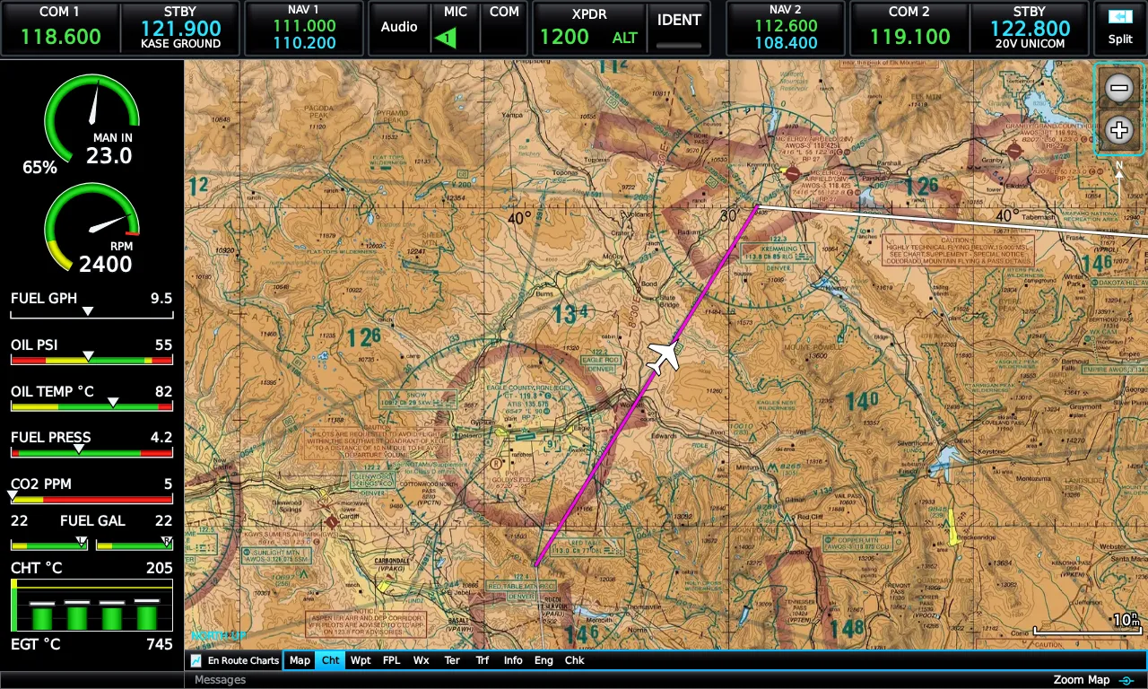
Section titled “En Route Charts”The Charts page is a moving map whose basemap is the FAA raster chart — georeferenced VFR sectional, IFR low, or IFR high — with your ownship, route, and traffic drawn directly on it. If a chart product isn’t in your installed data pack, the page says so plainly rather than silently swapping products. Orientation can follow your map settings or stay north-up.
Plates, diagrams, and the Chart Supplement
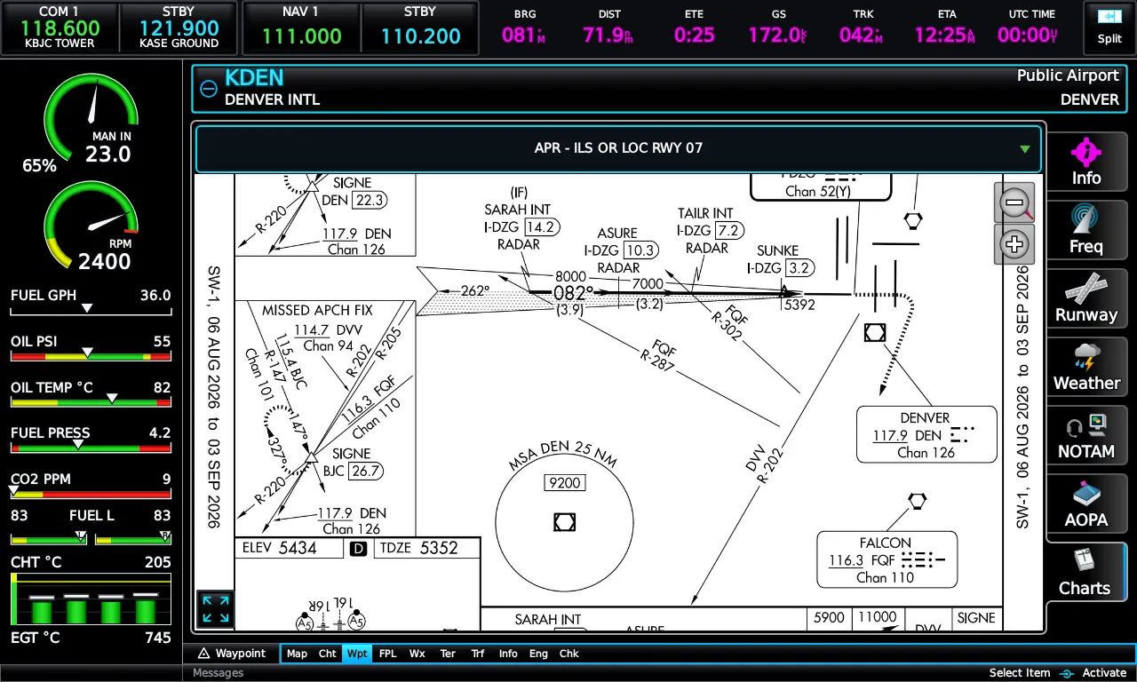
Section titled “Plates, diagrams, and the Chart Supplement”FAA publications live on the Waypoint page’s Charts tab: current-cycle approach plates (APR), departures (DP), arrivals (STAR), and info documents — airport diagrams and the Chart Supplement entry — one tap from the airport’s waypoint page. The first plate selects automatically and the viewer expands to full screen.
Emrelia E3X is an independent product of Emrelia LLC. It is not affiliated with, endorsed by, or sponsored by Garmin Ltd. or its affiliates. G3X Touch™ is a trademark of Garmin Ltd. For flight simulation use only — not for use in real-world navigation. Map imagery contains data © OpenStreetMap contributors (ODbL) and other sources — see data attributions. © 2026 Emrelia LLC.